Frightening Facts about Narragansett Bay
Halloween 2013
On Halloween, Environment Rhode Island released Frightening Facts about Narragansett Bay, a fact sheet that compiles ten of the most "scary" realities facing Rhode Island’s most iconic waterway. The fact sheet comes on the heels of an Environmental Protection Agency (EPA) announcement of its intention to move forward with a rulemaking to restore Clean Water Act protections to streams and wetlands across the country.
Downloads
Environment Rhode Island Research & Policy Center

…. Or read the facts here:
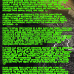
– 14% of Narragansett Bay’s watershed is covered with impervious surfaces such as roads, parking lots, and rooftops. When rain hits impervious cover, instead of filtering into the ground, it picks up pollutants and carries them through waterways out to Narragansett Bay. This runoff includes chemicals and pollutants from roads and pavement, bacteria and nitrogen from animal waste, and trash. [1]
– An estimated 50,000 cesspools still exist in Rhode Island. Cesspools do not adequately treat wastewater, and allow poorly treated wastewater to seep into groundwater. Many cesspools overflow and leak sewage into the ground, sending bacteria and nutrient pollution into the Narragansett Bay watershed. [2]
– Prior to initial construction of a new overflow tunnel, over two billion gallons of untreated sewage were sent into Narragansett Bay and its watershed every year from combined sewage overflows (CSOs) in the Narragansett Bay Commission District. CSOs occur when heavy rain overwhelms sewage treatment systems and, as a result, untreated wastewater is released into waterways. Luckily, the Narragansett Bay Commission has completed phase 1 of a 3-phase project to address CSO discharges into Narragansett Bay. [3]
– 10 years ago, low oxygen conditions brought about the Greenwich Bay Fish Kill, which left an estimated one million fish dead. Although the Bay has not seen a massive fish kill since, dissolved oxygen levels are still problematic in Greenwich Bay and upper Narragansett Bay. [4] Nutrient pollution from excessive levels of nitrogen and phosphorus––from various sources, including CSOs, cesspools, and other sources like fertilizers––can cause algae blooms that result in depleted oxygen levels in the Bay. [5]
– Beach closures rose again in 2013 after several years of improving water quality. Beaches are closed when bacteria counts in the water are high enough to threaten human health. Because bacteria counts increase with stormwater runoff and sewage overflows, increased beach closures this summer can be linked to abnormally high rainfall. [6]
– Volunteers along Rhode Island’s coast picked up 8094 plastic bags, 7186 plastic bottles, 12,755 caps and lids, 6169 plates and pieces of disposable cutlery, 1486 balloons, and 43,023 cigarettes and filters in a recent Ocean Conservancy cleanup. Plastic trash in Narragansett Bay threatens wildlife and will take up to hundreds of years to break down. [7]
– Fish yields in Narragansett Bay have declined over 80% since the 19th Century, mostly due to overfishing in recent decades. [8]
– Narragansett Bay has experienced an estimated surface temperature change of almost 3°F since 1960. This finding is consistent with what science tells us about the effects of global warming. Temperature changes on this scale bring significant changes to the marine ecosystem. [9]
– Sea level in Narragansett Bay has risen 10 inches since the 1930s, and if global warming continues unchecked, the rate is only expected to increase going forward. Coupled with more frequent and severe storms brought by global warming, changes like these pose a severe threat to coastal communities. [10]
– More than half of Rhode Island’s streams and hundreds of acres of wetlands are vulnerable to pollution and development as a result of Supreme Court decisions that have stripped Clean Water Act protections from small streams and wetlands. These waterways are the same ones that feed the Bay and help to keep it clean.
[1] http://www.ltrs.uri.edu/research/NENZhouWang.pdf
[2] http://www.dem.ri.gov/programs/benviron/water/permits/isds/pdfs/lwsumcsp.pdf
[3] http://www.narrabay.com/ProgramsAndProjects/Combined%20Sewer%20Overflow%20Project.aspx
[4] http://www.dem.ri.gov/bart/latest.htm
[5] http://www.providencejournal.com/breaking-news/content/20130819-decade-after-massive-fish-kill-narragansett-bay-healthier-but-work-remains.ece
[6] http://www.health.ri.gov/data/beaches
[7] http://act.oceanconservancy.org/pdf/Marine_Debris_2011_Report_OC.pdf
[8] http://www.nbnerr.org/Content/SiteProfile08/14_Chapter%2012_Human%20Impacts.pdf
[9] http://www.watershedcounts.org/climate.html
[10] http://www.crmc.ri.gov/climatechange/RICCC_2012_Progress_Report.pdf
